River Maps
-
Categories: Float Maps
Hannon to Darby
-
Categories: Rock Creek
Rock Creek Float Map
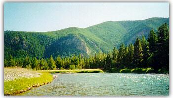
Rock Creek flows northward from the Sapphire Mountains to its confluence with the Clark Fork River About 20 miles east of Missoula. Rock Creek Road parallels the waterway for most of its 40 some miles of state and private land. It is generally not a float river other than in late May and the month of June when water levels... -
Categories: Rock Creek
Rock Creek Seasons
April/May: Similar to the Blackfoot, Rock Creek can be fairly unpredictable for dryfly fishing in April due to cold water and shaded canyon environment. Unlike the Blackfoot, however, nymph fishing this time of year is almost always good on Rock Creek, and more often than not, the dryfly fishing will be very good as well. Like all Missoula area rivers... -
Categories: Missouri River
Missouri River Float Recommendations
The Missouri is big, flat, water with the typical tailwater hatches and fish behavior. With one of the highest fish per mile counts of area rivers, this is a great place to either float or wade while concentrating on smaller chunks of river. It's one of our ace in the hole rivers during runoff periods west of the divide since... -
Categories: Missouri River
Missouri River Seasons
April/May/June: This is a great time of year to be on the Missouri since the summer crowds have not shown up yet and the fish are on the surface to a variety of hatches. In April, fisherman can expect to see midge hatches so thick that floating carpets of the insects drift downstream that are as big as school buses... -
Categories: Bitterroot River
Bitterroot Float Maps
The Bitterroot River flows northward towards Missoula and pretty much parallels Hwy 93. The most commonly floated area of the Bitterroot is from Hannon Memorial south of Darby all the way downstream to the confluence with the Clark Fork just west of Missoula. There is some floating to be had on the West Fork of the Bitterroot as well, but... -
Categories: Bitterroot River
Bitterroot River Seasons
April/May: Along with the Clark Fork, the Bitterroot River is the first one to produce very good, early season, dryfly fishing. Beginning in April, the skwala stoneflies and nemoura stoneflies begin to hatch in great enough numbers to get big fish to the surface. While the Bitterroot doesn't have nearly the skwala hatch intensity of the Clark Fork, there's no... -
Categories: Big Blackfoot
Blackfoot Maps
There are about 51 miles of river here that constitute Hwy 200. Eventually the Blackfoot dumps into the Clark Fork River about 7 miles east of Missoula. Beginning near the town of Ovando, both Harry Morgan and River Junction accesses tend to be the uppermost launches although there are several others farther upstream. There are almost no floats on this... -
Categories: Big Blackfoot
Blackfoot River Seasons
April/May: Early season on the Blackfoot is much less predictable than either the Bitterroot or The Clark Fork, but when it fishes, it fishes BIG!! If the water temperature warms up to the point where the fish are active, Skwala stoneflies and grey drakes will motivate fish to the surface that will range from 6" up to 30". This is... -
Categories: Missouri River
About the Missouri River
The Missouri River is one of our favorite rivers east of the divide. With water characteristics very similar to the Clark Fork, but with tailwater aspects, a good day on "the Mo" can take your breath away. Only two hours out of Missoula, the Missouri is a very good option and safety net during the uncertain runoff conditions the Missoula...
